GTN 725Xi
$16,700.00
The price listed is for the unit only. Installation may require additional parts. Contact us for a complete quote.
Next-Generation Performance
The GTN 725Xi brings more pixels, processing power, and speed to the industry's premier GPS/MFD platform. Its powerful dual-core processors boost graphical capabilities, enabling faster zooming, panning, and map rendering on a high-resolution display that features wider viewing angles and nearly double the pixel count of its predecessor.
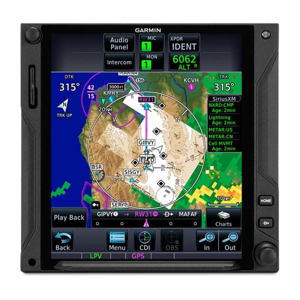
Intuitive Touchscreen Interface
The 6.9-inch do-it-all touchscreen provides quick access to moving maps, terrain, traffic, and weather. Pilots can use smartphone-like pinch-to-zoom and swipe gestures for navigation, or utilize the on-screen QWERTY keyboard and traditional concentric knobs for easy data entry of frequencies and waypoints.
Smart Glide™ Technology
In the event of engine power loss, Smart Glide technology reduces pilot workload by recommending suitable airports within glide range, creating a Direct-to route, and providing shortcuts for emergency transponder codes. When paired with a compatible Garmin autopilot, it can automatically engage best glide speed and navigate toward the selected airport.
Advanced IFR Capabilities
Visualize the full picture with graphical routing for departures, arrivals, and instrument approaches. The WAAS/SBAS-certified receiver enables LPV glidepath approaches down to 200-foot minimums, while the system supports advanced features like vertical navigation (VNAV) profiles, radius-to-fix legs, and holding patterns.
Connext® Wireless Connectivity
Stream information between your avionics and mobile devices running Garmin Pilot or FltPlan Go. With an optional Flight Stream 510 gateway, Database Concierge allows you to upload databases from your tablet in minutes and sync them automatically with your avionics stack.
Enhanced Situational Awareness
Integrate with ADS-B "In" solutions to display up to 60 traffic targets with TargetTrend™ tracking and TerminalTraffic™ displays. The unit also supports SiriusXM satellite weather, Garmin GWX digital radars, and georeferenced SafeTaxi diagrams to track your location on hundreds of airports.
Need Help Choosing?
Our team of aviation experts can help you select the right avionics solution for your aircraft. Contact us for personalized recommendations.